
Mick Larson, Mapping and Tech Coordinator, Giga Technology Centre
Connecting every school to the internet starts with knowing exactly where those schools are. Accurate geolocation data is not just a technical detail – it is the foundation for planning connectivity projects and ensuring governments can allocate resources where they are most needed. Yet, getting this data right is often a challenge. In this blog, Mick Larson, Mapping and Tech Programme Coordinator at Giga, explains why geolocation validation of schools is critical and how Giga is partnering with governments to improve data accuracy.
Giga’s mission to connect every school to the internet starts with solving a fundamental problem: many government datasets lack complete or accurate school location information. Through its validation work, Giga helps governments build reliable, high-quality data that informs decision-making and accelerates connectivity initiatives. This groundwork gives governments a clear and reliable picture of where schools are located.
Some of the common issues encountered in datasets include:
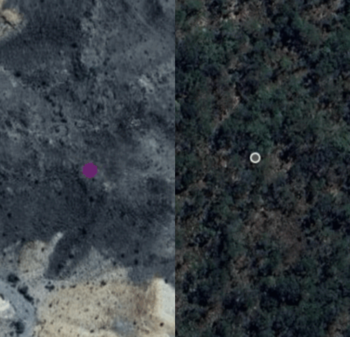
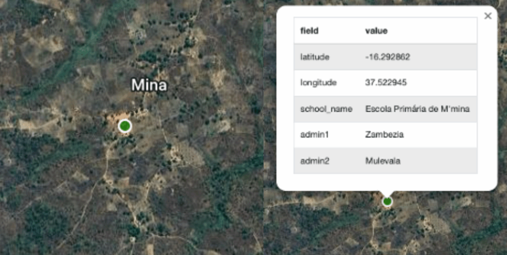
- Schools appear to be in uninhabited areas (see images of two schools below).
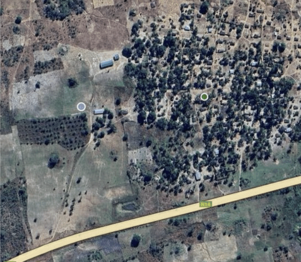
- Coordinates place schools in town centres instead of actual school buildings.
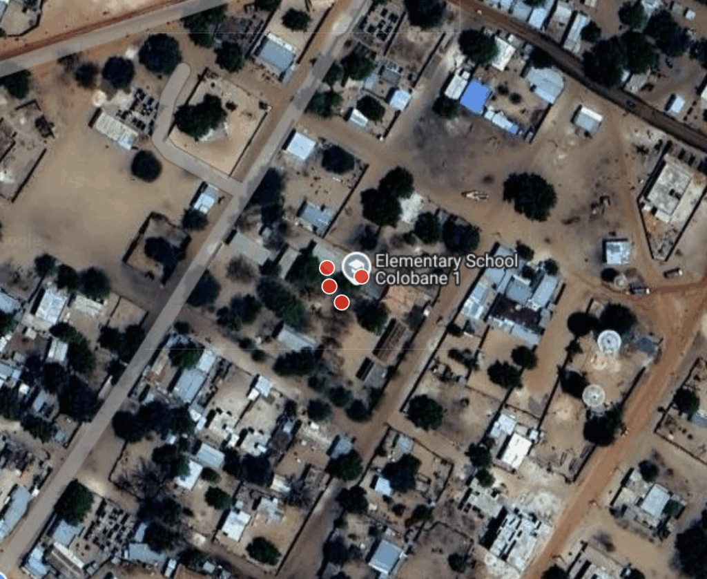
- Multiple schools have the same coordinates.
- Other issues encountered are input errors for e.g. duplicate or swapped entries and schools listed without any geolocation data.
Giga begins by auditing and refining existing school location datasets, merging them into a consolidated source to improve data integrity. Schools with ambiguous or missing coordinates are flagged for verification and incorporated once validated. For schools lacking geolocation data, Giga leverages AI-generated supported school location predictions to identify potential matches. Most locations are confirmed through this remote validation workflow, while only those that cannot be resolved using geospatial and AI tools are escalated for in-country field verification. This systematic approach minimizes manual data collection, creates one authoritative dataset, and significantly reduces the overall cost of nationwide school connectivity.
Validation methods and key tools
To ensure accurate school geolocations, Giga employs a combination of approaches and data sources including:
- existing school datasets provided by governments and partners.
- comparative data sources such as high-resolution satellite imagery, Overture, and OpenStreetMap (OSM).
- AI-predicted school locations generated by Giga’s Applied Science Team to identify schools with missing coordinates.
In each country, Giga collaborates with validators who have local contextual and geographic expertise. These validators are often embedded within Ministries of Education, enabling faster approval and integration of validated data into the Education Management Information System (EMIS).
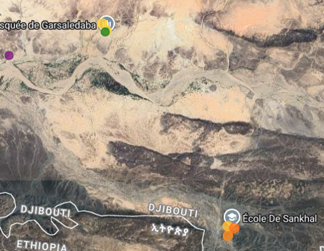
Country use cases: Djibouti and Mozambique
Working closely with the Ministry of Education in Djibouti, Giga mapped more than 80 per cent of schools nationwide and is now applying AI-based predictions to locate schools with missing coordinates, creating a complete and accurate national school list.
Wigdan Kays Aboubaker, ICT Officer at the UNICEF Djibouti Country Office, emphasized the importance of this work:
“A major challenge during the early mapping phase was the meticulous extraction of GPS coordinates for schools, as well as other key data such as the number of classrooms, year groups and pupils. Doing this manually using an online map and other sources was very time-consuming, so I reached out for support to the Giga team and that’s how Giga AI-based mapping came into play in Djibouti, using machine learning to identify schools from satellite imagery. It was a game changer!”
Wigdan Kays Aboubaker, ICT Officer at the UNICEF Djibouti Country Office
As part of a national effort to extend connectivity to schools, the government of Mozambique and Giga are working to geolocate nearly 3,000 schools from the country’s EMIS that currently lack coordinates. The process involves a multi-layered approach using:
- government school geolocation data.
- AI-predicted school locations to identify missing coordinates.
- OpenStreetMap (OSM) data layer for additional reference.
- satellite imagery layers from Bing and Environmental Systems Research Institute (ESRI) for visual verification.
These layers are compared and cross-referenced to validate school locations and fill gaps in the dataset. By integrating official data, AI predictions, and open-source mapping, Giga helps create a complete and accurate national school map – critical for planning connectivity initiatives.
This foundational work sets the stage for the next pillar of the Giga connectivity journey – modelling, which analyses the infrastructure gaps in school connectivity. It presents governments with options to close them affordably and sustainably, provides associated costs, and offers a connectivity plan for advancing school connectivity.
Find out more about Giga’s pillars of work at https://giga.global/what-we-do/how-we-work/.
About the Author

Michael (Mick) Larson is a technology and product leader with a passion for using tech to solve complex global challenges.
His expertise spans strategy, metrics, process development, and leveraging technology for good – particularly in the context of international development. Mick works out of The Giga Technology Centre in Barcelona.