Author: Kira Intrator
What if AI could change lives and transform quality of life for communities at risk? Driven by this vision, Kira created The Habitat Assessment tool, a geographic AI tool now serving over 9,000 users across six countries to enhance infrastructure planning and disaster preparedness. This achievement underscores her commitment to AI for Social Good and her belief.
“With AI, let’s not just build the best models, let’s make the greatest impact for good.”
Kira Intrator
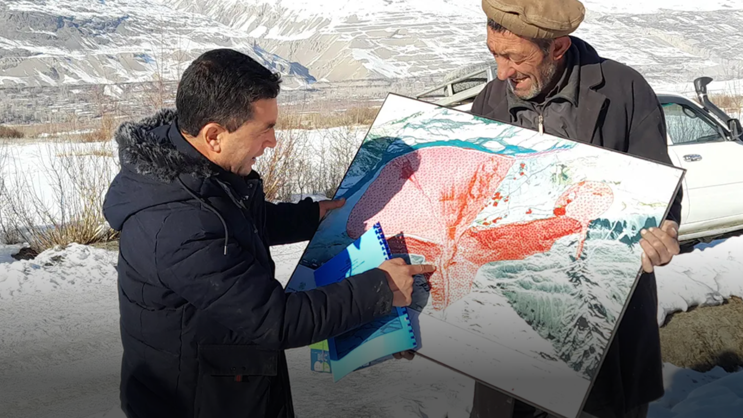
The Habitat Assessment Tool
The Habitat Assessment tool integrates diverse datasets – socio-economic indicators, hazard assessments, environmental analyses, building-stock inventories, essential services and infrastructure data, satellite imagery, and global datasets – into a unified Geographic Information System* (GIS) platform. Leveraging AI in a strategic and targeted manner for data capture, cleaning and automated modeling, the tool delivers precise assessments of vulnerabilities, land suitability, and long-term planning needs.
In addition to supporting governments, experts, and communities in designing and delivering resilient housing and essential services, the tool also serves as an evidence base for private-sector infrastructure investment, helping identify viable locations for telecom expansion, utilities, transport corridors, and climate-resilient development.
The Habitat Assessment tool turns complex data into clear, actionable insights that drive smarter decisions and guide policies. Building on this success, it has been used for 19 infrastructure projects in six countries and saved Euro 500,000 in just six months as well as unlocked Euro 3.5 million in infrastructure investments.
Use Cases
The tool has demonstrated value for:
- Governments for rural and urban planning, resource allocation, prioritization of infrastructure, and directing investments.
- NGOs and civil society for spatial assessment of community needs over time, monitoring and evaluation, and prioritization.
- Private sector and donors for identifying areas for investment, socio-economic impact, and geographic areas of rapid growth.
Community Participation
Community participation is at the heart of the tool with participatory exercises conducted through the data collection process to ensure insights from impacted communities are reflected. As climate change accelerates, communities face rising risks – from floods and droughts to infrastructure failures and displacement. By combining AI-driven insights with participatory data collection, it ensures that plans reflect both scientific evidence and community realities. In a world where climate impacts are no longer a distant threat but a present reality, tools like this are not just innovative – they are essential for safeguarding lives and shaping sustainable futures.
*Geographic Information System is a technology that allows for capturing, storing, analyzing, and visualizing spatial or geographic data. GIS combines maps with data, so you can see patterns, relationships, and trends tied to locations.
Giga: Convening for Impact
Giga brings together leading expertise in AI, technology and data to advance practical solutions for social good. It creates the conditions for collaboration, where organizations pool evidence, experience and technical capability to solve real-world problems. Giga’s support is designed with children and youth at the centre, ensuring technology serves their needs rather than the other way around. By connecting schools to the internet, Giga opens access to information, skills and opportunity, giving every young person a fair chance to thrive.
About the Author
Kira Intrator is a global leader in AI for Social Good, driving ethical and scalable innovations across healthcare, education, disaster response, and infrastructure. She spearheads multimillion-euro initiatives in collaboration with governments, academia, businesses, and nonprofits worldwide. Connect with Kira Intrator on LinkedIn.